
Consultancy Services for Preparation of Master Plan Report for Meriç-Ergene and North Trakya Part of Marmara Basins
- Financing : Equity Capital
- Service : River Basin Master Plan, Basin Water Management
- Employer : State Hydraulic Works, 11th Regional Directorate
- Project Duration : 2014 - 2018
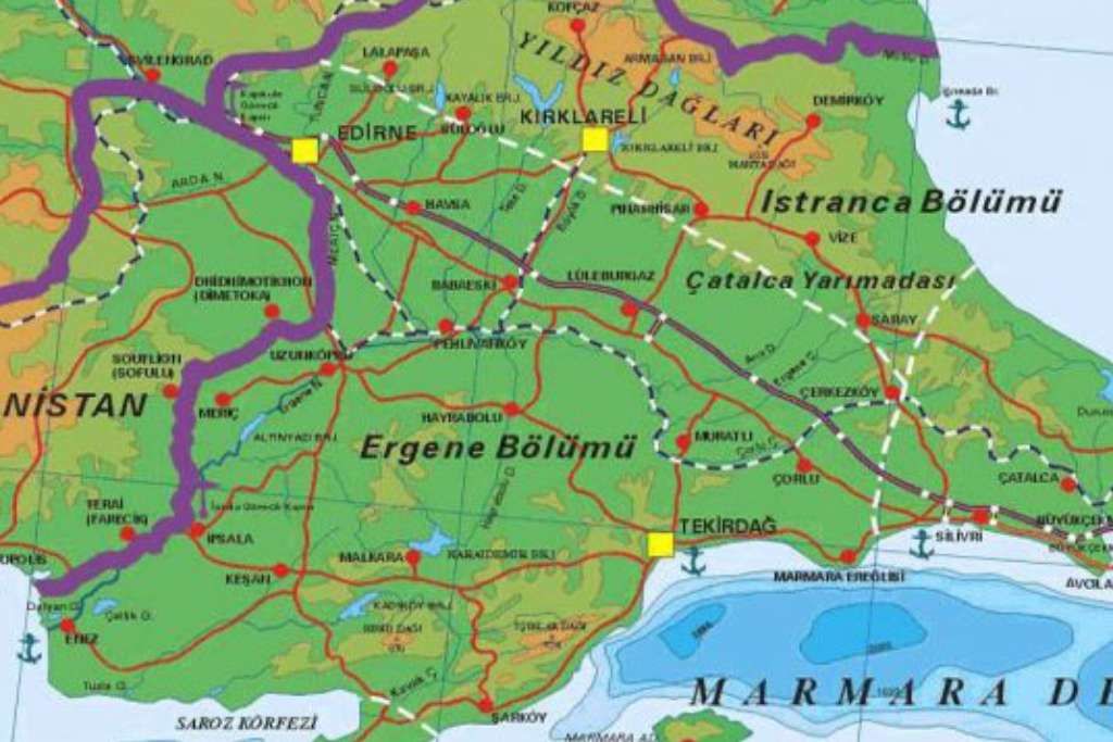
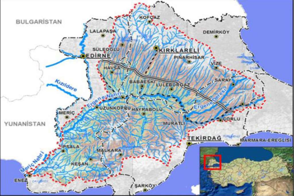
Master Plan Studies for Meriç Ergene and North Trakya Part of Marmara Basins were carried out for 22.000 km2 area and approximately 15 million inhabitants for target year 2070. The basins covered Edirne, Tekirdağ, Kırklareli provinces and European side of İstanbul and Çanakkale provinces.
The study assessed water resources for dams, regulators, tunnels, wells, galleries, irrigation, and drainage and overflows plants in order to reduce flood risks and proposed the construction of those infrastructure investments that are environmentally and economically viable.
Services provided by ALTER;
- Collection of data, topographical and hydrogeological and geotechnical surveys, Identification of basin boundaries, monitoring flow observation and hydrometeorological stations,
- Preparation of environmental assessment report,
- Development of preliminary and final reports for basin hydrology and hydrogeology considering climate change,
- Analysis of land classification and drainage in the basin,
- Preparation of preliminary and final reports for basin water consumption (drinking, potable, irrigational, industrial and commercial, and natural flow etc.),
- Assessment of agricultural economy in the basin,
- Preparation of basin land classification and drainage preliminary and final reports,
- Evaluation of flood and sediment control,
- GIS Mapping (1/25000 scale) and recommendations for prevention of flood risks and soil erosion